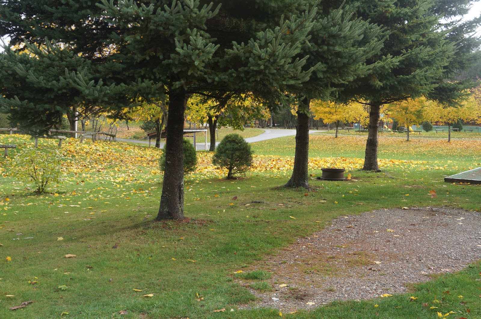
Back in January, 2011, we were stranded here by an ice storm for three days. Same campground, but today it has green grass instead of the yellow brown straw it had back then.
Another thing we noticed yesterday is that we have knocked around this part of the country long enough to be criss-crossing our previous paths. Especially the state of New York. We have entered and crossed the state from three of its four sides. But then, our path on a map is usually quite 'zig-zaggy' ..... we just identify places we want to visit and then connect the dots.
Tomorrow we will aim for making it all the way (diagonally) across the state of Virginia.
We will then cross down into North Carolina and spend some time in Asheville (one of my favorite places).
Later, Marilyn
Tuesday, November 6, 2012

Monday, November 5, 2012
Scranton, Pennsylvania
Just an overnite stop on our trek south. After visiting our friends in Massachusetts, we headed west to try to get further inland and avoid gasoline and other shortages (normally we would have gone down the coast thru New Jersey). So tomorrow we head down thru Virginia and into North Carolina. Tonite here has snow flurries predicted, but not to accumulate ..... I am a little worried about the new storm coming up that we will have to go thru late tomorrow and Wednesday. Oh well, worse case scenario is we would have to stop and get winterized ..... but we could still travel. Thank God for our furnace working smoothly !
Later, Marilyn
Later, Marilyn
Saturday, November 3, 2012
shop shop shop ... shop
We're on the move again .... whoope-e-e-e.
Freeport, Maine. We made it two hours down the road; found a huge outlet mall ..... and you can guess the rest. We're still here in the parking lot; gonna spend the nite.
Tomorrow we'll try for a little further. Next stop is about 3+ hours away, visiting friends Mark and Debbie in Charlton, Massachusetts.
More later, Marilyn
Freeport, Maine. We made it two hours down the road; found a huge outlet mall ..... and you can guess the rest. We're still here in the parking lot; gonna spend the nite.
Tomorrow we'll try for a little further. Next stop is about 3+ hours away, visiting friends Mark and Debbie in Charlton, Massachusetts.
More later, Marilyn
Tuesday, October 30, 2012
all to ourselves
Well, they closed the campground; but they don't turn the electricity off until next Monday, so we're using our own internal tanks and water pump..... and enjoying the beautiful setting we have all to ourselves. There are a few trailers left stored here for the winter; and the owner lives just down the road ... so he comes driving thru a couple of times a day to check on the place.
I just went out and took photos of us and our views:
 The owner left us three trash cans.... to last a week .... ?


 This is our "side yard"
Since there's no one else here, we sometimes let the dogs off leash to run and play .... and roll in the grass and leaves.
We are pretty pleased with our temporary home..... as long as this 50-60 degree weather holds out.
Later, Marilyn
I just went out and took photos of us and our views:

I saw a wild turkey hen down at the bottom of this field just before I took the photo.

Since there's no one else here, we sometimes let the dogs off leash to run and play .... and roll in the grass and leaves.
We are pretty pleased with our temporary home..... as long as this 50-60 degree weather holds out.
Later, Marilyn
Saturday, October 27, 2012
Bangor, Maine
Well, this is starting to feel like home .... sort of. That's a good thing .... since we have 10 more days to spend here. Normally we would take off for some side trips and then return for Vera's appt. on the 5th; but since we have 'weather' predicted here (wind gusts 40-60 and lots of rain) we will just 'shelter in place'..... and pray there's no severe cold episodes.
Since I'm a little short on news of exciting adventures ...... I'll add a few additional pictures from down on Mount Desert Island, mostly in Acadia National Park.
These are from the top of Cadillac Mountain, with Bar Harbor below (with a couple of cruise ships in port).
You can see what I've been saying about the islands being solid rock, and shaped by the ancient glaciers.


These next two are Sand Beach in Acadia; and a view of the Penobscot River from an observation tower in Bucksport (which is at the head of a large bay a few miles inland).


These next three are of downtown area of Bangor. The two houses (historical mansions) are representative of the French influence seen so much. The last is a bad photo, but I wanted to show what the downtown 'flavor' is.


 And last, a sample of the variation of color seen within a single tree.
Oh, I do have one more 'exciting' thing to report. Our campground is about a half mile from the end of a runway at the Bangor airport. The good news is Bangor International doesn't have a real heavy schedule of large commercial planes. The bad news is the National Guard has a base there and shares the runway for its really big transports and refuelers (those big tankers that refuel the fighter planes in the air) that seem to run training shifts 24/7. It literally wakes us up about 1:30 am every morning. Other than that it is really quiet out here now that there are only two campers left in the park.
Later, Marilyn
Since I'm a little short on news of exciting adventures ...... I'll add a few additional pictures from down on Mount Desert Island, mostly in Acadia National Park.
These are from the top of Cadillac Mountain, with Bar Harbor below (with a couple of cruise ships in port).
You can see what I've been saying about the islands being solid rock, and shaped by the ancient glaciers.


These next two are Sand Beach in Acadia; and a view of the Penobscot River from an observation tower in Bucksport (which is at the head of a large bay a few miles inland).


These next three are of downtown area of Bangor. The two houses (historical mansions) are representative of the French influence seen so much. The last is a bad photo, but I wanted to show what the downtown 'flavor' is.


Oh, I do have one more 'exciting' thing to report. Our campground is about a half mile from the end of a runway at the Bangor airport. The good news is Bangor International doesn't have a real heavy schedule of large commercial planes. The bad news is the National Guard has a base there and shares the runway for its really big transports and refuelers (those big tankers that refuel the fighter planes in the air) that seem to run training shifts 24/7. It literally wakes us up about 1:30 am every morning. Other than that it is really quiet out here now that there are only two campers left in the park.
Later, Marilyn
Friday, October 26, 2012
Hurricane ?? !!
We will be here in the Bangor area until Nov. 6th .... the day after Vera's followup doctor visit. We are getting pretty nervous about getting caught here in the first winter storm...... but who would have figured we'd get cornered by a hurricane ! I say "cornered" because we'd probably run inland if there were a way to. But there's not really: no freeways running east/west ... only one freeway and it runs down south into the hurricane path, or north up to the Canadian border. The roads heading west are so slow (small state roads running thru a jillion small towns), that we'd still be "running" this time next month. So we are where we are. At this point it seems the storm will come inland just about where we planned to be about two weeks from now..... plan adjustments are in order.
We are in a very pretty campground, which is closing "at the end of the month". I think after this weekend we will be the only ones left here. But the water gets turned off this coming Monday, then the sewer gets shut down, then on the following Monday the electricity gets turned off ...... so they gave us some discounts, and we'll just dry camp and use our generator occasionally. But we will have the whole place to ourselves. Good thing the moon is getting fuller, or it could get a little dark around here.
We took the coach out today and filled up with diesel (for the generator), and propane (for the heater ... 30 to 40 degree nights).
Later, Marilyn
We are in a very pretty campground, which is closing "at the end of the month". I think after this weekend we will be the only ones left here. But the water gets turned off this coming Monday, then the sewer gets shut down, then on the following Monday the electricity gets turned off ...... so they gave us some discounts, and we'll just dry camp and use our generator occasionally. But we will have the whole place to ourselves. Good thing the moon is getting fuller, or it could get a little dark around here.
We took the coach out today and filled up with diesel (for the generator), and propane (for the heater ... 30 to 40 degree nights).
Later, Marilyn
Monday, October 22, 2012
13 inches per hour
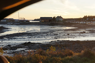
One of the interesting things we have been watching while we've been here on Mount Desert Island, is the tremendous height of the tides ..... 12 to 13 feet. Right now in this phase of the moon it is running 13 feet every 12 hours. Now, I'm not into the details of the tide charts nor do I claim to understand tides very much ...... but to me that translates into 13 inches per hour. That's really a lot. On our way into town, we see piers on mudflats, boats lying on the shore, etc, ..... and on the way back from town that same pier is surrounded by water and the boats are floating. The two pictures bbelow are taken from the roadside at approximately the same point. It's just something I'm not used to seeing and it fascinates me.

Another thing that really fascinates me is the "footprint" of glaciers upon this area. The historical information here says that this area was once covered by ice at least a mile thick ..... talk about a heavy load! There is very little topsoil (one reason for the forests being shorter), and the granite rock of this area is seen everywhere. The islands are all shaped (in profile) similarly due to the ice sheet sliding up over one end, and fracturing the opposite end into sharp cliffs as it moved on the downside.

Even the mountains on the big island have the same shape:

We did a short hike today .... 1 1/4 mile, but it was along a rocky shore trail .... so it was probably more than Vera should have done with her "tired" pacemaker .... but wow, was it invigorating. (Vera gets her pacemaker replaced Wednesday as an outpatient).
 That's Vera on the trail.
Here's another picture of the carriage trail from "the carriage":

Tomorrow afternoon we will move the motorhome back up to Bangor, Maine (1 hour North). We will stay there, closer to the hospital, for several days after Vera's surgery. We will need to stay in this area until her followup visit in about 10 days ..... so we may come back down here to Mt. Desert Island for another week. We love it here !!!!!
Oh, one more thing: Mount Desert Island was named in 1604 by Champlain when he discovered and mapped it; but it was a long french phrase which meant "mountain void of vegetation". So the word "desert" is meant like the verb "to desert", or to leave deserted, (not the noun like something sweet to eat). The french name was later shortened.
Later, Marilyn


Another thing that really fascinates me is the "footprint" of glaciers upon this area. The historical information here says that this area was once covered by ice at least a mile thick ..... talk about a heavy load! There is very little topsoil (one reason for the forests being shorter), and the granite rock of this area is seen everywhere. The islands are all shaped (in profile) similarly due to the ice sheet sliding up over one end, and fracturing the opposite end into sharp cliffs as it moved on the downside.

Even the mountains on the big island have the same shape:

We did a short hike today .... 1 1/4 mile, but it was along a rocky shore trail .... so it was probably more than Vera should have done with her "tired" pacemaker .... but wow, was it invigorating. (Vera gets her pacemaker replaced Wednesday as an outpatient).

Here's another picture of the carriage trail from "the carriage":

Tomorrow afternoon we will move the motorhome back up to Bangor, Maine (1 hour North). We will stay there, closer to the hospital, for several days after Vera's surgery. We will need to stay in this area until her followup visit in about 10 days ..... so we may come back down here to Mt. Desert Island for another week. We love it here !!!!!
Oh, one more thing: Mount Desert Island was named in 1604 by Champlain when he discovered and mapped it; but it was a long french phrase which meant "mountain void of vegetation". So the word "desert" is meant like the verb "to desert", or to leave deserted, (not the noun like something sweet to eat). The french name was later shortened.
Later, Marilyn
Subscribe to:
Posts (Atom)